
HUDSON VALLEY
Cultural Resource Consultants, Ltd.
PO Box 264, Salt Point, NY 12578
914-456-3698
P a g e | 1
September 14, 2021
Chairwoman Loretta Taylor
and Members of the Town Planning Board
Town of Cortlandt
1 Heady Street
Cortlandt Manor, NY 10567
Re: Palisades Fuel
2056-2060 E. Main Street
Town of Cortlandt, Westchester County
Dear Chairwoman Taylor and Members of the Planning Board:
Hudson Valley Cultural Resource Consultants (“HVCRC”), submits this letter in response to the comments
issued at the August 31, 2021 Public Hearing, regarding the Palisades Fuel project (the “Project”) at 2056-2060
E. Main Street (“Project Parcel”). Among other things, this letter discusses: (i) the availability of staff to be
present at the public meeting, (ii) the research process for the Phase 1A Literature Review and Sensitivity
Assessment, completed in July of 2021, (iii) the probability of a burial ground on the property, and use of
Ground Penetrating Radar (GPR), and (iv) the condition of the interior of the structure at 2056 East Main
Street (“Brick Structure”).
MEETING AVAILABILITY AND ATTENDANCE
We acknowledge the Board’s request to have a member of HVCRC staff attend the public and Project related
meetings. Unfortunately, HVCRC currently has six (6) projects before various Town Boards. Currently one is
meeting the first Tuesday of every month, and these meetings have been ongoing for several months. This
created the conflict that prevented HVCRC staff from attending the August 31, 2021 meeting. I am the member
of HVCRC staff who carries the Historic Preservation credentials and due to other ongoing meetings, I am not
available to attend the October 5
th
2021 meeting. I would be pleased to schedule a time to meet with the Board
to answer any questions and clarify any points as needed, but as stated I have a current commitment on Tuesday
the 5
th
of October 2021.
While, another staff member from HVCRC could be present, Ms. Gilleland currently holds the 36CFR 61
qualifications as an Archaeologist. She would be able to respond to the Board’s questions as they pertain to
identifying cemeteries and the use of GPR, but would not be able to address matters pertaining to the building
and historic preservation.
PHASE 1A LITERATURE REVIEW AND SENSITIVITY ANALYSIS REPORT
The Phase 1A Literature Review and Sensitivity Analysis Report (Phase 1A Report) completed in July of 2021
complies with the current New York State Standards.
1
In that regard there are standard sections that are
included in the report. However, the research for this project was expanded to include deed research
2
and
extra effort was exerted to identify resources that would have relevant information as it pertains to the Brick
Structure. As outlined in the report, the deeds currently housed at the Westchester County Records Office were

P a g e | 2
reviewed, local historical repositories
3
and online forums
4
along with the published histories of Westchester
County were reviewed to gather information as it pertains to the brick structure and the Project Parcel.
LOCATION OF A BURIAL GROUND ON THE PROJECT PARCEL
The Board members have raised a concern about the presence of a burial ground within the boundaries of the
Project Parcel. No record of a burial ground within the Project Parcel, or adjacent to its boundaries was
encountered during the expanded research completed for the Phase 1A report. The historic landowner maps
do not identify a cemetery within the vicinity of the Project Parcel.
5
Nor did a review of County Cemetery
records suggest that burial ground was located within or adjacent to the Project Parcel.
6
Should the Board be
willing to furnish HVCRC with the source of the information indicating that a burial ground is located within
the Project Parcel, I would be willing to complete further research on this topic.
Prior to the mid-nineteenth century large rural cemeteries were uncommon. The trend at the time was for the
deceased to be buried in a family or church plot. These family plots were located in a variety of environments
and in different locations on family property. While burial grounds do occasionally occur near houses, they are
strategically placed to avoid contamination of the wells, both for livestock and human occupants.
7
As a result
of the potential for contamination, burial grounds were commonly located further away from the wells and
structures that were regularly inhabited.
Did the expert do more than walking the site?
A surface reconnaissance of the property was completed. Most historic burial grounds tend to lack headstone
markers, either they have eroded or rotted, are unidentifiable as they consist of unmarked natural stones, or
have been moved or relocated.
8
When natural stones are used, they are flat pieces that are arranged as
headstones and footstones, or put upright in the ground as headstones.
9
Another indicator of a burial ground
is grave subsidence. Grave subsidence is caused by the natural settling of soils after burial, and decay and
collapse of the coffin. These deep linear depressions are identifiable on the ground surface. None of these
indicators of a burial ground were noted within the Project Parcel.
The surface reconnaissance revealed that there are large boulders located within the area disturbed by the
construction of the Bear Mountain Parkway, and in the slopes that ascend to the properties fronting along
Floral Road. The existing nature of the ground surface, sloped with eroding bedrock and boulders, makes this
an unlikely location for a burial ground.
In addition, there has been significant prior disturbance within the Project Parcel, as a result of previous
activities by the occupants of the Brick Structure. The landscape to the north of the building has been cut and
graded. Currently there is sharp change in elevation between the hill side and the level patio on the northwestern
side of the building. This sharp change in elevation also exists on the northeastern side of the building. To the
west of the current parking area, cutting and filling from the construction of the Bear Mountain Parkway has
altered the landscape.
Was ground penetrating radar used?
Ground Penetrating Radar (GPR) is a remote sensing technique that can be used as non-invasive method for
examining subsurface cultural features. The results of the GPR survey depends on a variety of factors, including
surface conditions, soil type, moisture content, and the particular targets that are being investigated. Natural
features, such as rodent burrows, boulders and tree roots can create clutter within the results.
10
GPR surveying requires a precise grid overlying the known or suspected location of a burial ground. As no
evidence of a burial ground was identified in the historical records, there was no reason to proceed with a GPR

P a g e | 3
investigation. GPR surveys can be an unreliable method as tree roots, rocks, shallow bedrock, fill soils and the
overall moisture composition can interfere with the antenna’s ability to receive a pulse, and the pulse reflected
to the receiver will vary and is likely to create subsurface anomalies that may be mistaken for buried cultural
material. In addition, the antenna needs to be in close contact with the ground surface. GPR pulses cannot
penetrate bedrock. The shallow depth of bedrock with produce reflections that will prevent the identification
of historic features. Furthermore, rock on the ground will prevent the antenna from making sufficient contact
with the ground surface to send a pulse for the receiver to read.
Without a reference of the cemetery, or information pertaining to its location, a GPR study is not optimal. In
addition the surface conditions within the parcel make it unlikely that a conclusive result would be the outcome
of such a study.
Were there any test bores done?
A test trench was completed on the western side of the building on September 13, 2021. The careful monitoring
of mechanically excavated trenches is a common practice to determine if a burial ground is present.
11
The
location was chosen as it represented a level area that would have been the most likely location of a community
burial ground. The soil profile identified consisted of 2.5’-3’ of fill soils (top soil mixed with asphalt, asphalt
dust and gravel) overlying glacially sterile soil (C horizon). The existing soil profile indicates that at one time
the original top soil was removed, and the area was leveled and graded with soils brought in from another area.
Bedrock was reached at 6’ below grade in this location. Photographs of this test trench are included as Exhibit
B. Test pits completed elsewhere within the Project Parcel by the Applicant’s Environmental Consultant
indicate that the depth to bedrock is roughly 2’-4’ below grade. This shallow depth of bedrock, mixed with the
numerous boulders makes this an unlikely location for a burial ground.
CONDITION OF THE INTERIOR OF THE BRICK STRUCTURE
The interior of the building has been examined. Photographs of the interior are included in Exhibit A.
Did the historical expert go into the school house?
The interior of the house was assessed. Based on the continuous changes to the building all that remains from
its original construction is the brick shell and exterior roof material. Only one 19
th
century window was noted,
and it is unclear if it is original to the building. The dormers on the second floor, as well as the apartment, are
later 20
th
century additions. The additions to the northwestern corner, and north wall, and the kitchen and entry
addition on the southern elevation are also 20
th
century additions.
The original coal stove has been removed, along with any interior features that may have existed in the 19
th
century when the building was first constructed. Mid to late 20
th
century dividing walls and bathrooms have
been added to the interior of the first level of the Brick Structure. The flooring material is no longer original
to the building, and numerous iterations of ceilings were noted. The most recent being a drop ceiling that
houses HVAC components, and hides mid twentieth century ceiling tiles, over ship-lap style boards.
Interior walls are constructed with sheet rock. In the northern addition, the interior finish materials have
significantly deteriorated, and the wall boards have collapsed away from the roof and brick wall. The southern
addition consists of the former restaurant kitchen, and entry way and is a late 20
th
century addition. The second
floor has been fully altered in the mid to late 20
th
century to function as an apartment. This renovation included
the addition of two dormers on the western side of the building. The southernmost dormer is no longer sealed
against the elements, and significant water damage has caused deterioration of the interior. There is notable
bowing in the exterior of the roof on the southern side of this dormer. The northernmost dormer is the location

P a g e | 4
of the apartment’s kitchen. This area has also experienced significant water damage, as the northern wall is
bowing inward, and does not appear to be structurally sound.
The foundation of the Brick Structure has been constructed of mortared brick which has been parged over
with a layer of cement. Currently there is more than two feet of water within the basement of the structure.
The basement features cast iron supports, on which the floor joists rest. These supports are covered with rust.
The numerous pipes and mechanical components in the basement also exhibit deterioration and corrosion.
The floorboards were black with rot and contained substantial amounts of mold and fungus.
With the exception of the brick walls of the building there does not appear to be any historical elements
associated with the building's historic use and intent. Steam radiators were added in the late 19th and early 20th
century. The windows were also replaced at various times throughout the past few centuries, with only one 19
th
century window noted.
Historic preservation is about not only the structure, but also its function and its history.
12
This historic
intention was irreversibly abandoned by change in the use of the building in the 20th century. The historic
intention and function of the building was as a school house. Overall the historic intent and function of the
building has been lost. The structure no longer retains the integrity of its original purpose.
Thank you sincerely for your thoughtful consideration to this matter, and if you require any further information
to facilitate your review of the Project, please do not hesitate to ask.
Sincerely,
Beth Selig
President, Hudson Valley Cultural Resource Consultants (HVCRC)

P a g e | 5
1
Standards for Cultural Resource Investigations and the Curation of Archeological Collections published by the New York
Archeological Council (NYAC) and recommended for use by New York State Office of Parks, Recreation and Historic
Preservation (OPRHP).
2
Deed Research is recommended only for Phase 2 Investigation Level Reports. See note 1.
3
Peekskill Local History Collection, the Colin T. Naylor, Jr. Archives and & Peekskill Museum at Herrick House.
4
Abandoned Peekskill Facebook Group, Newspapers.com, Heritage Quest Census data, Ancestry.com.
5
Phase 1A Literature Review and Sensitivity Assessment. Palisades Fuel. Town of Cortlandt, Westchester County, New
York. July 2021. Figures 5-9.
6
Patrick Raftery. 2009, Westchester County Cemetery Index. Westchester County Archives.
7
Jessie Lee Faber. 2003, Early American Gravestones. American Antiquarian Society.
8
J. Wilson Poucher, and Helen Wilkinson Reynolds, 1939. Nineteen Thousand Inscriptions. Collection of the Dutchess County
Historical Society, Volume II. Poughkeepsie, NY. Ross W Jamieson, 1995 “Material Culture and Social Death: African
American Burial Practices.” Historical Archeology. Vol. 29 (4):39-58.
9
Ross W Jamieson, 1995, “Material Culture and Social Death: African American Burial Practices.” Historical Archeology.
Vol. 29 (4):39-58.
10
Lorenzo H., V. Perez-Garcia, A. Novo, J. Armesto, 2010, Forestry Applications of Ground Penetrating Radar in Forest Systems.
19(1)-1-15.
11
Guidelines for the use of Archaeological Monitoring as an Alternative to Other Field Techniques NYAC adopted
4/26/02
12
Theodore Prudon, Preservation of Modern Architecture, (New Jersey, John Wiley & Sons, 2008):161.

P a g e | 6
List of Exhibits:
Exhibit A: Interior Photos of the Brick Structure
Exhibit B: Photographs of the Test Trench
EXHIBIT A: INTERIOR PHOTOGRAPHS
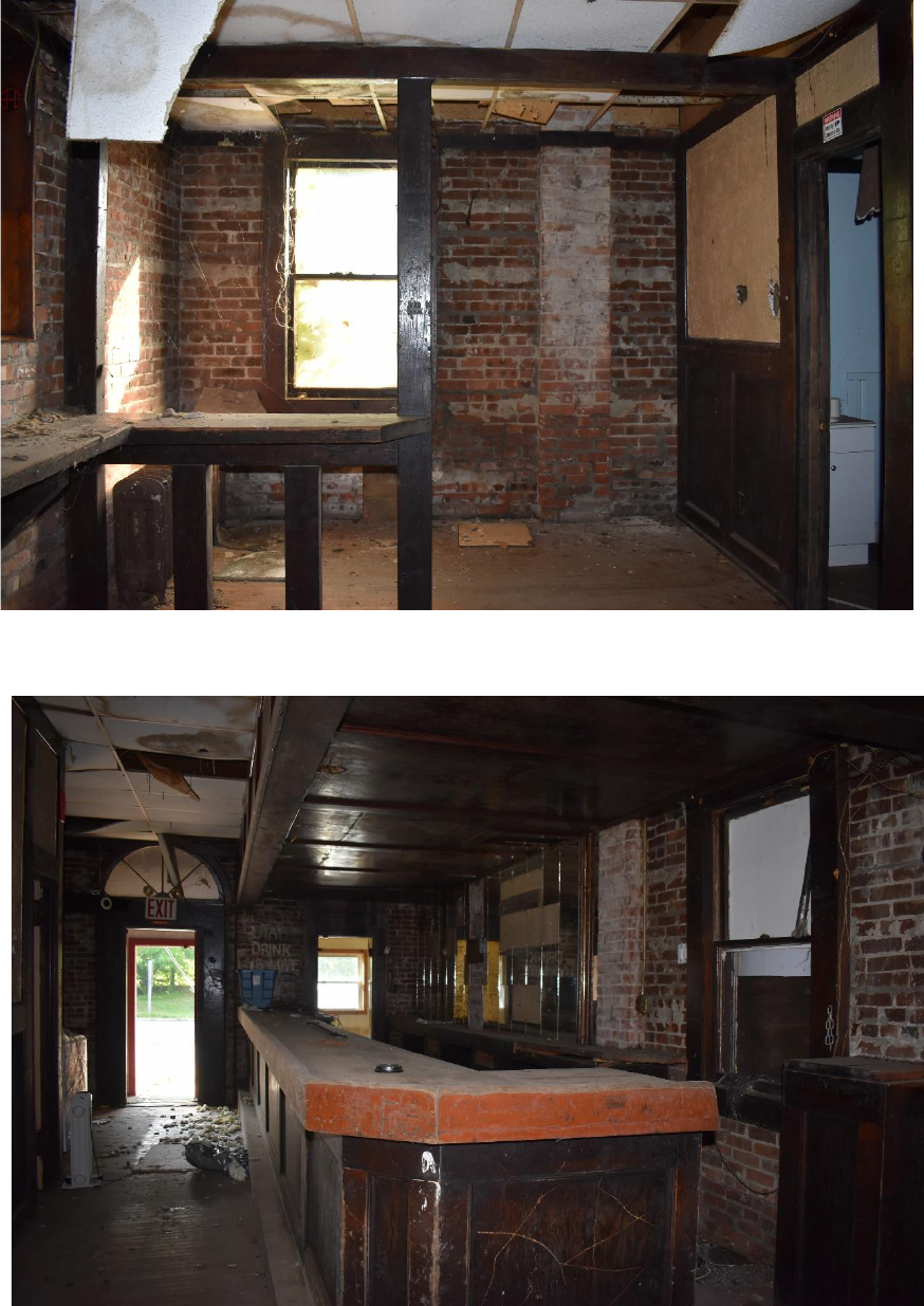
EXHIBIT A: INTERIOR PHOTOGRAPHS | 2
1. Interior-
view to the
east of the
northeastern
corner of the
Brick
Structure.
Window
dates to 19
th
century.
2. View to the
south of
the interior
of the brick
structure.
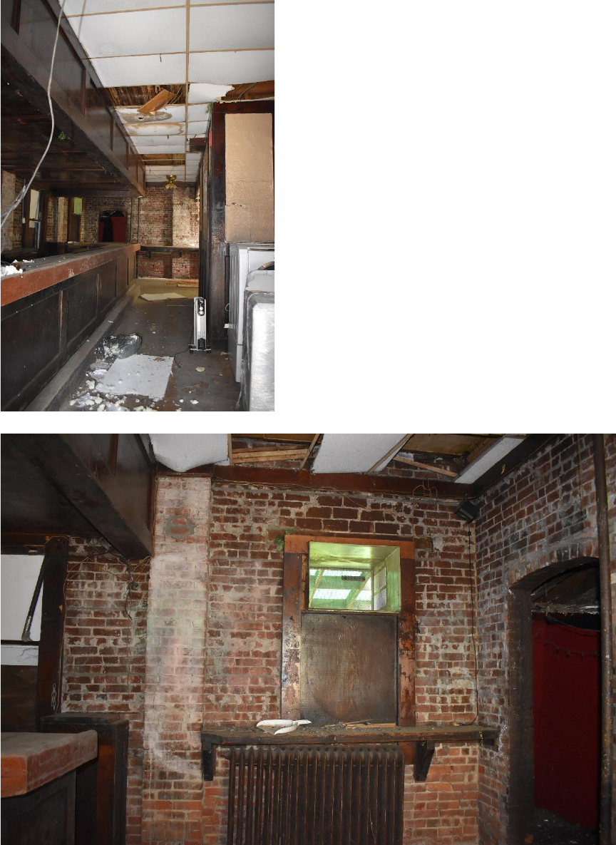
EXHIBIT A: INTERIOR PHOTOGRAPHS | 3
3. View to the
north of
the interior
of the brick
structure.
Interior
walls and
drop
ceiling are
modern
additions.
4. View to the
west of the
northweste
rn portion.
Steam
radiators
are later
additions.
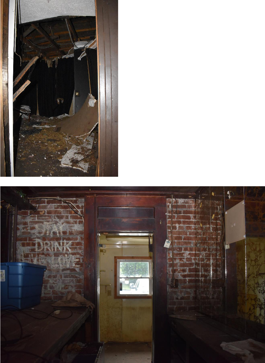
EXHIBIT A: INTERIOR PHOTOGRAPHS | 4
5. View to the
northeast of
the northern
addition.
The interior
of this space
is
deteriorating.
6. View to the
south toward
the kitchen
addition on
the southern
side of the
building.
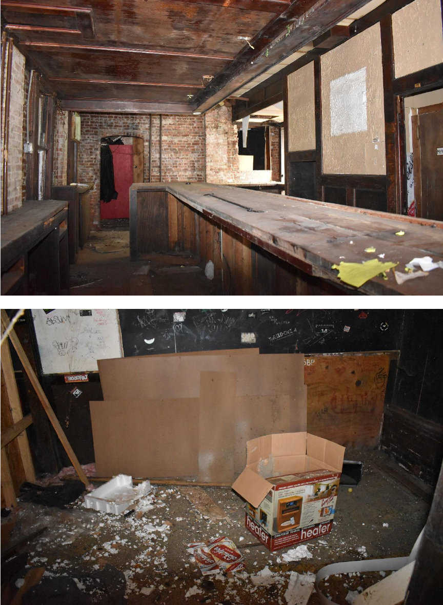
EXHIBIT A: INTERIOR PHOTOGRAPHS | 5
7. View to the
north from
the
southwestern
corner of the
brick
structure.
8. View to the
west of the
northern
addition.

EXHIBIT A: INTERIOR PHOTOGRAPHS | 6
9. View to the
north of the
northern
addition.
Lumber
indicates a
mid-late 20
th
century
construction
date.
10. The interior
of the
northern
addition has
completely
deteriorated.
View to the
southeast.
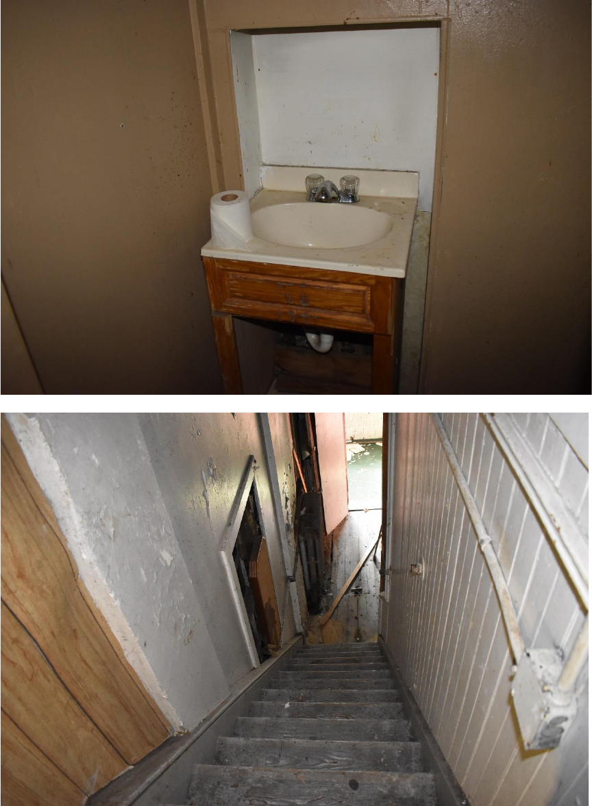
EXHIBIT A: INTERIOR PHOTOGRAPHS | 7
11. Bathroom
in the
interior of
the brick
structure.
View to the
west.
12. Stairs
leading to
the second
floor. View
to the
south.
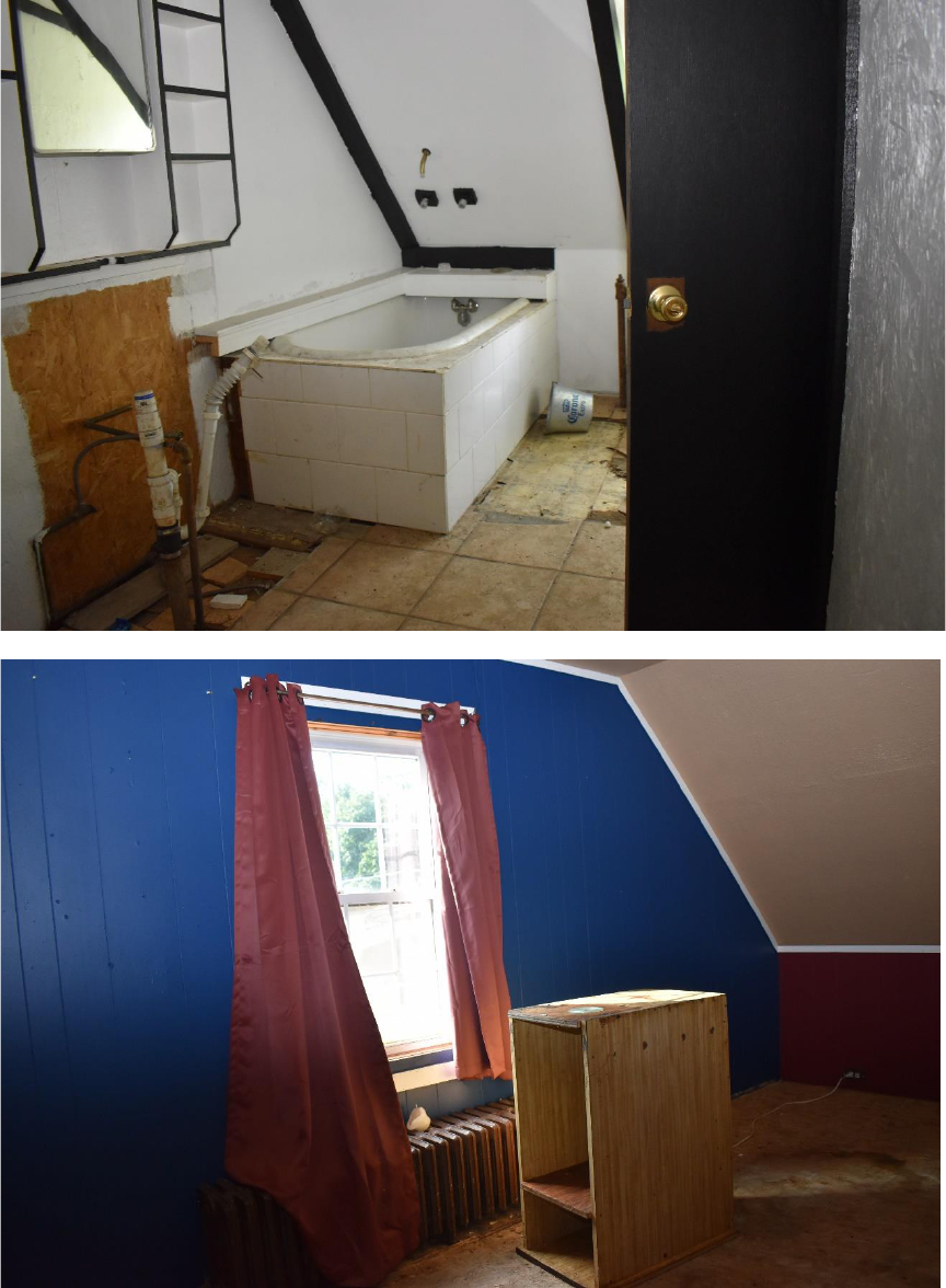
EXHIBIT A: INTERIOR PHOTOGRAPHS | 8
13. Bathroom
on second
floor. View
to the
southwest.
14. View to the
southwest of
southern
window.
Window is a
modern vinyl
replacement.
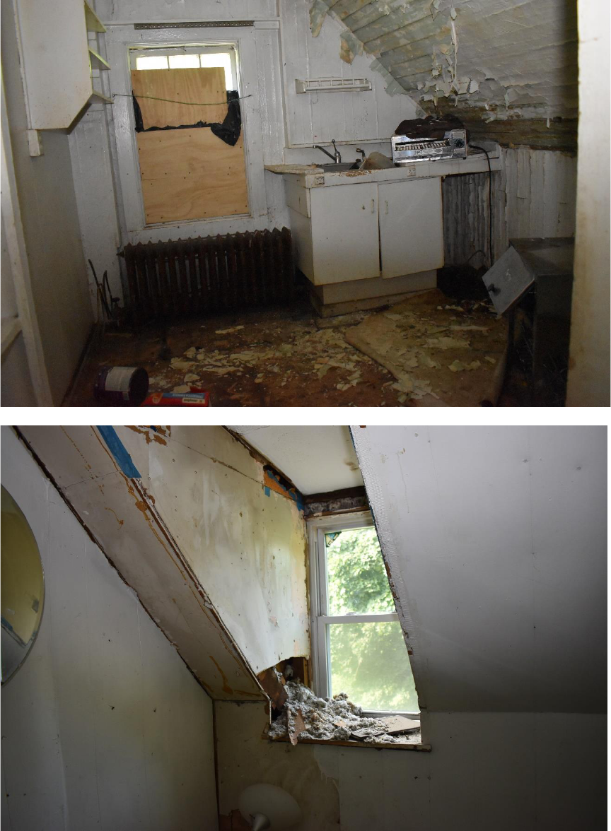
EXHIBIT A: INTERIOR PHOTOGRAPHS | 9
15. View to the
west of the
northern
dormer and
addition on
second
floor.
Shiplap to
the right in
photos is
collapsing
inward.
16. View to the
southwest
of the
southern
dormer.
Note the
significant
water
damage.
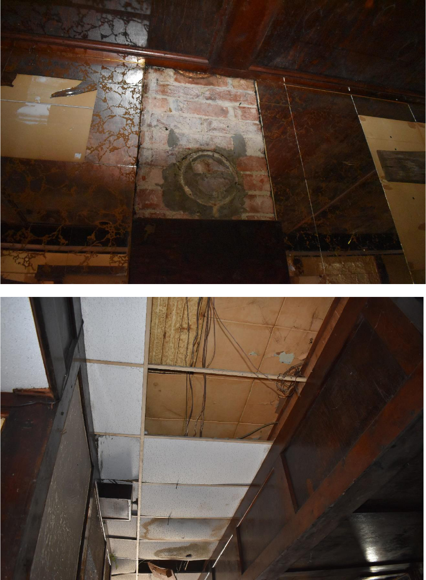
EXHIBIT A: INTERIOR PHOTOGRAPHS | 10
17. The
original
stove and
piping have
been
removed.
18. Drop
Ceilings
cover earlier
iterations of
ceiling
materials and
house HVAC
components.
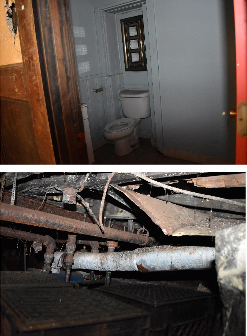
EXHIBIT A: INTERIOR PHOTOGRAPHS | 11
19. Second
bathroom
in interior
of brick
structure.
20. Pipes and
mechanicals
are located
in the
basement
of the
structure.
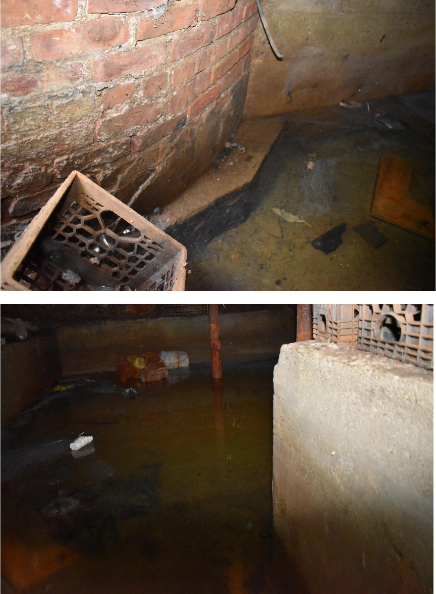
EXHIBIT A: INTERIOR PHOTOGRAPHS | 12
21. Foundation
is
constructed
of brick
and parged
with
cement.
22. Substantial
amounts of
water were
noted in
the
basement.
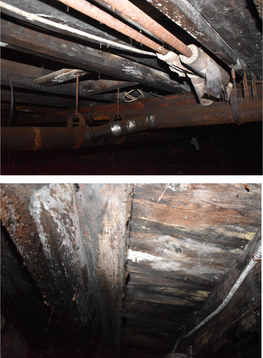
EXHIBIT A: INTERIOR PHOTOGRAPHS | 13
23. The water
infiltration
has caused
the pipes
and floor
joists to
deteriorate.
24. A
significant
amount of
rot, mold
and fungus
were noted
in the floor
joists.
EXHIBIT B: TEST TRENCH PHOTOGRAPHS | 14
EXHIBIT B: TEST TRENCH PHOTOS
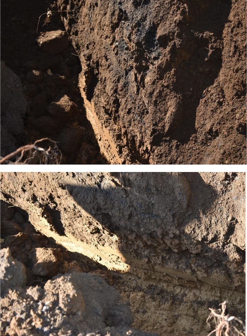
EXHIBIT B: TEST TRENCH PHOTOGRAPHS | 15
1. The test
trench
identified
fill
consisting
of soil,
asphalt,
gravel and
asphalt
dust.
2. The fill
material is
located on
top of
glacial
subsoil.
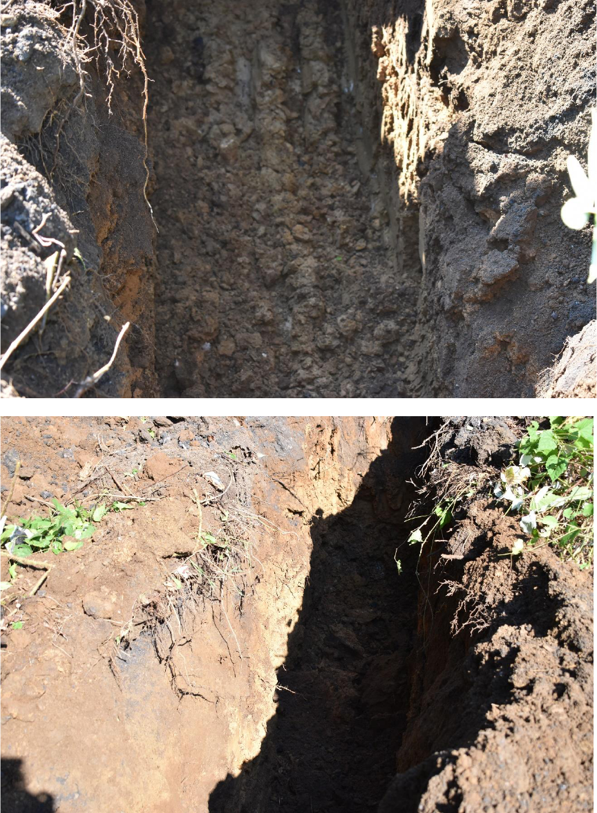
EXHIBIT B: TEST TRENCH PHOTOGRAPHS | 16
3. Bedrock was
encountered
at a depth of
6’ below
grade.
4. The test
trench was
15’ in
length, on
the western
side of the
brick
structure.
